
Fold-out map
The beach map for Ibiza
The island map from the airport and the car-rental desk: the Eivissa city map and twenty beaches on the front, the whole island on the back. Both sides here, with the beaches and symbols of the map as text.
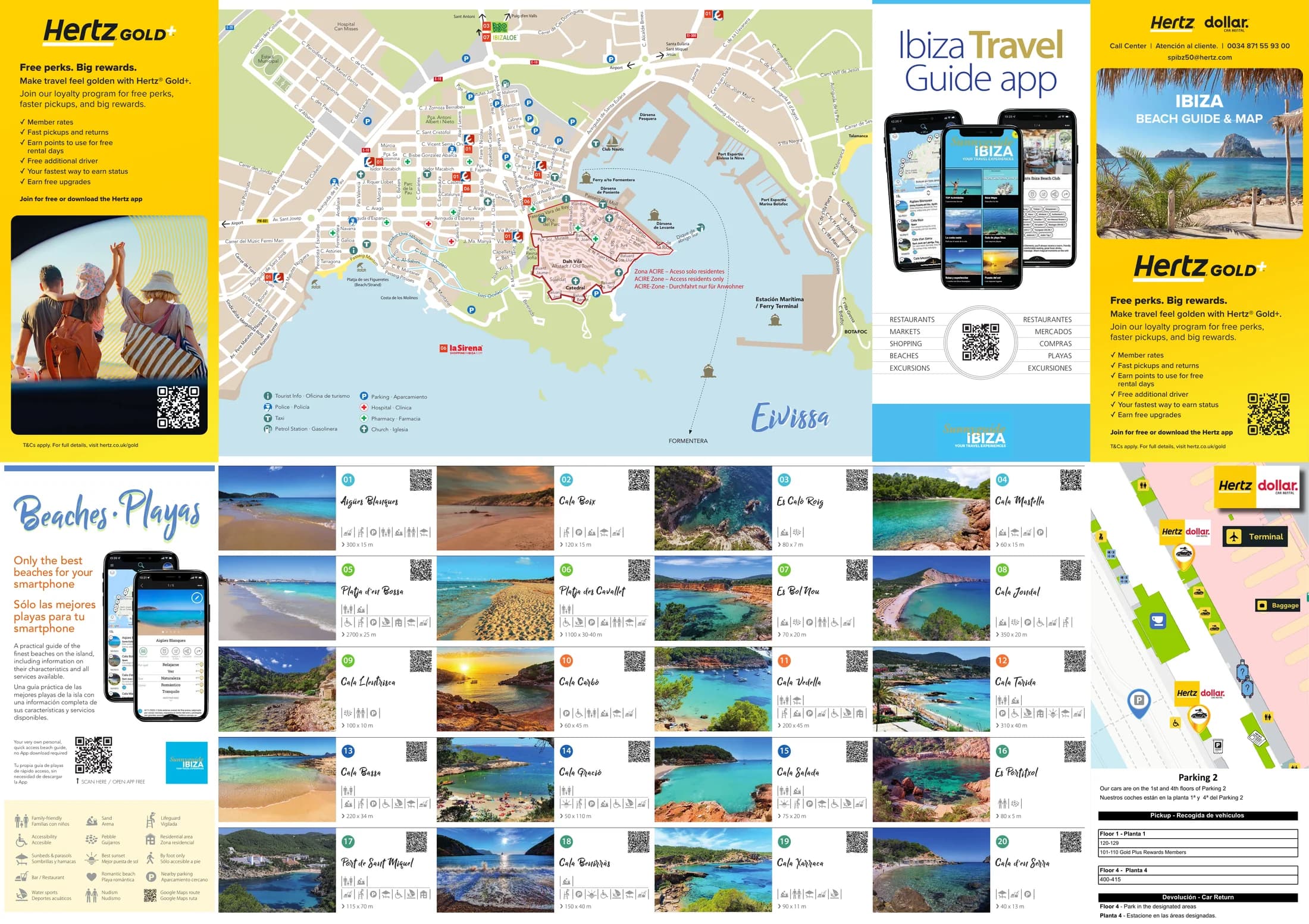
The fold-out map handed out at the airport and the car-rental desks: the Eivissa city map and the beach directory on the front, the whole island on the back. Below you find its directories and symbols as text, so you can read them without the paper.
Download this pageComplete map as PDF2 pages, 12 MB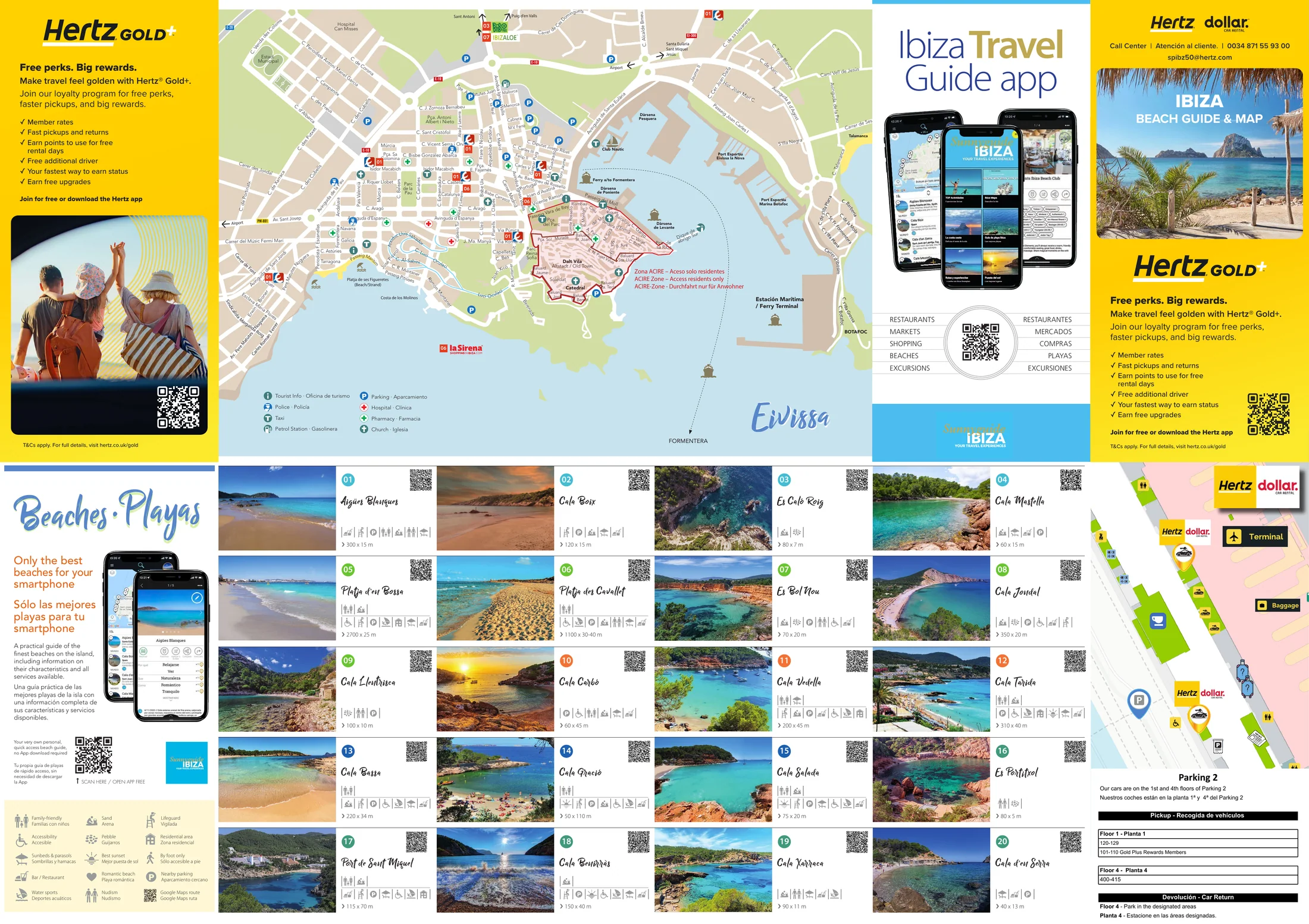
- Folded map, two sides
- 680 × 480 mm
- English and Spanish, the ACIRE note also in German
- 2026 edition
Published by Impresol Publicidad SL
Tap a thumbnail to see the page full size.
What is on the map
On the front, the Eivissa city map with eight symbols and the note on the ACIRE zone, below it twenty beaches with number, name and size. On the back, the island with twelve symbols, four road types, the same twenty beaches sorted by coast and fourteen spots for the sunset. All of it is here as text.
The beaches on the map
The map numbers the beaches from 01 to 20 and assigns them to five coasts. Headings and sizes appear here in the wording of the map. Where its two sides spell a name differently, both spellings are shown.
20 beaches, 01 to 20
EASTCOAST / ESTE
01Aigües Blanques
Size per the map: 300 x 15 m
02Cala Boix
Size per the map: 120 x 15 m
03Es Caló Roig
Size per the map: 80 x 7 m
04Cala Mastella
Size per the map: 60 x 15 m
SOUTHCOAST / SUR
05Platja d’en Bossa
Size per the map: 2700 x 25 m
06Platja des Cavallet
Size per the map: 1100 x 30-40 m
07Es Bol Nou
Size per the map: 70 x 20 m
08Cala Jondal
Size per the map: 350 x 20 m
09Cala Llentrisca
Size per the map: 100 x 10 m
SOUTH-WEST / SUROESTE
10Cala Carbó
Size per the map: 60 x 45 m
11Cala Vedella
Size per the map: 200 x 45 m
12Cala Tarida
Size per the map: 310 x 40 m
WESTCOAST / OESTE
13Cala Bassa
Size per the map: 220 x 34 m
14Cala Gració
Size per the map: 50 x 110 m
15Cala Salada
Size per the map: 75 x 20 m
NORTHCOAST / NORTE
16Es Portitxol
Es Portitxtol
Size per the map: 80 x 5 m
17Port de Sant Miquel
Size per the map: 115 x 70 m
18Cala Benirràs
Cala Benirrás
Size per the map: 150 x 40 m
19Cala Xarraca
Size per the map: 90 x 11 m
20Cala d’en Serra
Size per the map: 40 x 13 m
More of Ibiza on your phone
The app holds many more addresses for restaurants, shopping, activities, beach clubs and recommendations, and more beaches on Ibiza. Plus tours by rental car.
Go to the appBest sunset
A separate list on the back. The number in front is the marker on the map, not a ranking: a spot that is also in the beach directory carries its beach number there.
Best sunset · Mejor puesta de sol
- 01Es Codolar
- 02Cala d’Hort
- 10Cala Carbó
- 11Cala Vedella
- 12Cala Tarida
- 03Cala Llentia
- 04Cala Codolar
- 05Sa Figuera Borda
- 06Cala Comte
- 07Caló des Moro
- 14Cala Gració
- 08Punta Galera
- 15Cala Salada
- 18Benirràs
The symbols of the map
Three keys and the road types, with the words and as many language versions as the map prints.
At the beaches
- Family-friendly · Familias con niños
- Accessibility · Accesible
- Sunbeds & parasols · Sombrillas y hamacas
- Bar / Restaurant
- Water sports · Deportes acuáticos
- Sand · Arena
- Pebble · Guijarros
- Best sunset · Mejor puesta de sol
- Romantic beach · Playa romántica
- Nudism · Nudismo
- Lifeguard · Vigilada
- Residential area · Zona residencial
- By foot only · Sólo accesible a pie
- Nearby parking · Aparcamiento cercano
- Google Maps route · Google Maps ruta
On the Eivissa city map
- Tourist Info · Oficina de turismo
- Police · Policía
- Taxi
- Petrol Station · Gasolinera
- Parking · Aparcamiento
- Hospital · Clínica
- Pharmacy · Farmacia
- Church · Iglesia
On the island map
- Airport · Aeropuerto
- Ferry-Harbour · Puerto
- Petrol station · Gasolinera
- Marina · Puerto deportivo
- Beach · Playa
- Golf course · Campo de Golf
- Lighthouse · Faro
- Monastery · Santuario
- Church · Iglesia
- Cave · Cueva
- Radar
- Tourist Info · Oficina de turismo
Road types
- Motorway · Autopista
- Main road · Carretera principal
- Minor road · Carretera secundaria
- Other roads · Otras carreteras
The ACIRE zone in Eivissa
The map marks a zone in the old town and explains it in three languages. The wording, exactly as printed:
- Zona ACIRE – Aceso solo residentes
- ACIRE Zone – Access residents only
- ACIRE-Zone - Durchfahrt nur für Anwohner
Six editions for six partners
Impresol prints the Ibiza map for several partners, each with its own cover. They also differ in format and in content.
The texts on this page come from the 2026 Hertz edition.
Where to get the map
Handed out free to holidaymakers: airport and car-rental desk. If you do not have one at hand, you can look at the same map above.
For businesses
Would you like to be on this map?
On a fold-out map the advertising slot sits right next to the map image. That guarantees high visibility. Both sides of this map offer a select range of advertising space for local businesses.
- Folded map, two sides, 680 × 480 mm
- Six brand editions, each with its own cover
- Keys in English and Spanish
- Advertising slots along the edges of both sides
Frequently asked questions
- What does the Ibiza map show?
- Two sides. On the front the Eivissa city map with the harbour and the old town, plus the beach directory with photo, number and size. On the back the whole island with the road network, the beaches by coast and the spots for the sunset.
- How many beaches are on the map?
- Twenty, numbered 01 to 20 and assigned to five coasts: east, south, south-west, west and north. Those are the twenty the map numbers, not every beach on the island.
- Which beaches are they?
- In the east Aigües Blanques, Cala Boix, Es Caló Roig and Cala Mastella. In the south Platja d’en Bossa, Platja des Cavallet, Es Bol Nou, Cala Jondal and Cala Llentrisca. In the south-west Cala Carbó, Cala Vedella and Cala Tarida. In the west Cala Bassa, Cala Gració and Cala Salada. In the north Es Portitxol, Port de Sant Miquel, Cala Benirràs, Cala Xarraca and Cala d’en Serra. Thirteen of the twenty carry the name Cala, the other seven are called Platja, Port, Es or Aigües.
- Is Cala Bassa on the map?
- Yes, as number 13. The map groups it under the heading WESTCOAST / OESTE together with Cala Gració and Cala Salada and gives 220 x 34 m. Cala Bassa appears on both sides of the map, in the beach grid on the front and in the coast list on the back.
- Is Cala Tarida on the map?
- Yes, as number 12 in the south-west. The map gives 310 x 40 m, and Cala Tarida appears once more in the sunset list.
- Which beach on the map is the longest?
- Platja d’en Bossa, at 2700 x 25 m the largest figure of the twenty. Which of the two numbers is the length, the map does not say. The figure stands here exactly as printed, without interpretation.
- Where is the best sunset on Ibiza?
- The map keeps a separate list of fourteen spots for it, among them Es Codolar, Cala d’Hort, Cala Comte, Caló des Moro and Punta Galera. Six of them are also in the beach directory and carry their beach number there.
- What do the beach symbols mean?
- Fifteen symbols, from sand and pebbles through lifeguard and parasols to the path you can only walk. The map explains them in English and Spanish, and that is the wording on this page.
- What is the ACIRE zone?
- An area in the old town of Eivissa that the map outlines in red. Its own wording: “ACIRE Zone – Access residents only”.
- What does the map cost?
- Nothing. It is handed out free of charge to holidaymakers, at the airport and the car-rental desk.
- Which editions of the Ibiza map exist?
- Six, each for a different partner: Class Rent a Car, Europcar, Goby Car, Goldcar, Hertz and Sixt. Their content differs: the Goby Car edition is portrait format and carries no beach directory at all. The texts on this page come from the Hertz edition.
- Is the map available as a PDF?
- Yes, at the top of this page the map is there as a PDF to download. Two pages, 12 MB, at the resolution of the print file, so it also prints well.
More from the publisher
Impresol publishes maps and travel guides for Mallorca, Ibiza, Menorca and Formentera.
See all publications